Quantcast
Channel: AWOL - The Ancient World Online
Viewing all 14065 articles
Browse latest View live

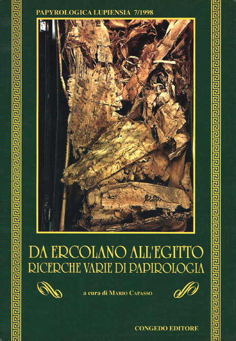
Open Access Journal: Papyrologica Lupiensia

0
0
Papyrologica Lupiensia
e-ISSN: 1591-2221

http://siba-ese.unisalento.it/cover/paplup.jpg
Papyrologica Lupiensiaè una pubblicazione del Dipartimento di Filologia Classica e di Scienze Filosofiche dell'Università di Lecce e del Centro Interdipartimentale di Studi Papirologici.

In questa rivista confluiscono i risultati delle ricerche promosse e sostenute dalla Cattedra di Papirologia e dall'insegnamento di Papirologia Ercolanese dell'Ateneo leccese.
La rivista nasce nel 1991 ed ha periodicità annuale.


1991

 See the full List of Open Access Journals in Ancient Studies

Open Access Journal: Pubblicazioni del Dipartimento di Beni Culturali dell'Università di Lecce - Settore Storico-Archeologico

0
0

News from the Comprehensive Aramaic Lexicon

0
0
Steve Kaufman passes along the following news of the Online Comprehensive Aramaic Lexicon:
Please advise your readership that I have turned on the lexicon itself, which can be found at http://cal.huc.edu!  There are also a few other tools that have been added or will be added shortly.

A brief list of its advantages:

The Advantages of the Online Comprehensive Aramaic Lexicon
Welcome to the first complete online academic lexicon of a classical Semitic language and the first dictionary of all of the classical dialects of Aramaic.  As an online dictionary, the CAL itself has many advantages over the traditional printed book:
  • Entries may be accessed by root, by canonical form, or by the complete form as found in texts.  For example, confronted by ובמלכותה the entry can be found by searching for the form as it is, by the root “mlk” or by the lemma “mlkw.” No longer is alphabetization an issue.
  • Entries may be accessed by the Aramaic word, by any English word used in the glosses, or by certain semantic fields.
  • Citations within entries may be searched.
  • Searching may use Roman transliteration, Unicode, Square script (Hebrew) or Syriac keyboards.
  • Citations from the database are linked to the full text.  Click on a citation in an entry to see it in its original context.  From the context, you will find yourself in text browse mode where a click on any other word displays the appropriate lexical entry.
  • A complicated entry may also be viewed without justifying citations so as to better study its overall semantic structure.
  • Entries display the page numbers where a word is treated in the major previous dialect dictionaries and, more importantly, links to online displays of those digitized pages where allowed by copyright.
  • There are no separate pages for abbreviations.  Hover with the mouse over an unfamiliar abbreviation and a revealing “tooltip” appears.
  • The CAL is live!  We are constantly adding texts, adding new words, and improving entries.  Active work is in progress improving our textbases and treatments of the less well-known dialects, in particular Mandaic, Samaritan, and Nabataean. All scholarly references to the CAL should thus include the date when the reference was found.  We invite corrections from users!
  • Although in the sense of the previous paragraph the CAL is not yet “complete,” we have decided to open the lexicon to academe: As of February, 2013, our database consists of over two million parsed words, over 30,000 individual lemmas (and 7,000 cross-references), over 60,000 glosses, and about 20,000 citations.

Open Access Journal: Hierasus publicaţie anuală a Muzeului Judeţean Botoşani

0
0
 Hierasuspublicaţie anuală a Muzeului Judeţean Botoşani
Apărută în anul 1978, sub denumirea de "Hierasus", publicaţia anuală a Muzeului Judeţean Botoşani şi-a schimbat din anul 1999 titlul în "Acta Moldaviae Septentrionalis", vechiul anuar dorindu-se a fi rezervat exclusiv arheologiei. În cei peste 30 de ani de existenţă s-au publicat 11 volume.

Facsimil digital volumele:
I - 1978 (pdf 44 MB), II - 1979 (pdf 26 MB), III - 1980 (pdf 12 MB), IV - 1981 (pdf 49 MB), V - 1983 (pdf 35 MB), VI -1986 (pdf 15 MB), VII-VIII 1989 (pdf 23 MB), IX 1994 (pdf 28 MB), X - 1996 (pdf 16 MB), XI - 2001 (pdf 28 MB)

Open Access Serial: Gli Album del Centro di Studi Papirologici dell'Università degli Studi di Lecce

0
0

Benthos: Digital Atlas of Ancient Waters beta version

0
0
Benthos: Digital Atlas of Ancient Waters beta version
Screen Shot 2013-02-14 at 4.54.51 PM
Benthos is a new initiative of the Ancient World Mapping Center that aims to catalog and map the waters of the ancient Mediterranean basin, including both physical and cultural geography. The project will provide interactive maps of Mediterranean shipping networks, bathymetric data, and views of ancient coastlines. Currently the project is in a preliminary state, with a functional beta version of the application based off of Antiquity À-la-carte.
Click here or on the image above in order to launch the map application. This application works best with FirefoxChrome, or Safari and currently does not work correctly with Internet Explorer.

All site content and maps are released here under the Creative Commons Attribution-NonCommercial 3.0 Unported (CC BY-NC 3.0) license.


Open Access Journal: JVRP White Papers in Archaeological Technology

0
0
JVRP White Papers in Archaeological Technology(WPAT)
The WPAT series is designed to document the variety of technologies employed in the field and lab by the Jezreel Valley Regional Project. In some cases similar technologies are already being used by other excavations, in other cases, we present new technologies or new applications and procedures for existing technologies. In the papers below, you will find detailed summaries of technologies and their applications in archaeology, step by step procedures for using these technologies, detailed bibliographies and links for further information. Our goals for the WPAT program are to document and to make transparent our data acquisition as a supplement to our other publications, and to provide useful guides for other archaeological projects to utilize as they see fit. The papers are dynamic - they will be updated with new ideas, techniques, and technology over time.

John S. Latsis Public Benefit Foundation Digital Library

0
0
[First published in AWOL 3/27/09. Most recenty updated 2/19/2013]

Since 1997, the John S. Latsis Public Benefit Foundation has produced each year a volume devoted to a single archaeological museum, aiming to create a series whose scholarly prestige and aesthetic approach contribute to a deeper knowledge and further understanding of the various aspects of the history of Greek civilisation. These volumes are distributed free of charge to those who are on the foundation's mailing list, and to others who request them.

The foundation also issues them in open access digital format. The volume on Samos: The archaeological museums is the most recent to appear. Fourteen volumes are now available:

Sidestone Press e-library

0
0
Sidestone e-library
We believe scientific information should be available at all time, at all places and to each and every one. Therefore everyone is free to browse, search and read most of our publications online in our digital library. We only ask a small fee for downloading the PDF, this helps us keeping our library running! 
Among Sidestone titles relating to antiquity are:


Leatherwork from Qasr Ibrim (Egypt). Part I: Footwear from the Ottoman Period

André J. Veldmeijer

Throughout its long history, stretching from the 25th Dynasty (c. 752-656 BC) to the Ottoman Period (c. 1500-1811 AD), Qasr Ibrim was one of the most important settlements in Egyptian Nubia. The site has produced an unprecedented wealth of material and due to the – even for Egypt – extraordinary preservation circumstances, includes objects that are made of perishable organic materials, such as wood, leather, and flax. The present volume focuses on one of these groups: footwear that is made from leather and dated to the Ottoman Period.
More Information / Buy this book


Sandals, shoes and other leatherwork from the Coptic Monastery Deir el-Bachit. Analysis and Catalogue

André J. Veldmeijer

This book contains an analysis and detailed catalogue of sandals, shoes and other leatherwork from the Coptic Monastery Deir el-Bachit. It is the largest Coptic monastery complex preserved in Western Thebes and the first monastery that has been systematically investigated. The excavation of the monastery was started as a DFG-Project des Ägyptologischen Instituts der Ludwig-Maximilians-Universität München in close collaboration with the Deutsches Archäologisches Institut Abteilung Kairo.
More Information / Buy this book


Tutankhamun’s Footwear. Studies of Ancient Egyptian Footwear

André J. Veldmeijer

The discovery of Tutankhamun’s tomb by Howard Carter in 1922 is one of the most significant archaeological discoveries of all time. It took Carter and his team 10 years to clear the contents of the tomb and among the objects found was a large collection of shoes and sandals. The footwear is analysed here in detail for the first time since the discovery using Carter’s records and Harry Burton’s excellent photographs along with the author’s analyses of the objects, all of which are housed in the Egyptian Museum, Cairo and the Luxor Museum.
More Information / Buy this book


Amarna’s Leatherwork. Part I. Preliminary analysis and catalogue

André J. Veldmeijer

The ancient Egyptian city of Tell el-Amarna (or Amarna, ancient Akhetaten) was the short-lived capital built by the controversial Pharaoh Akhenaten, probably the father of the famous Tutankhamun. This volume, the first of two, presents the leatherwork excavated at the site by these various expeditions. The book consists of two parts: the catalogue and the preliminary analysis.
More Information / Buy this book

Oxford Archaeological Lead Isotope Database Online

0
0
OXALID: Oxford Archaeological Lead Isotope Database
http://oxalid.arch.ox.ac.uk/laurium%20p78%20coins%201.JPG
Lead isotope analysis is at present the most successful method of establishing the geographical origin of lead present in ancient metals and other materials, for which minerals containing lead were used in their manufacture, for example: pigments, glass, glaze and paint.   

This method of provenancing is based on comparisons of three lead isotope ratios of artefacts that are under investigation with the available lead isotope data for ore deposits.   The lead isotope ratios for comparisons have to be measured very accurately (with an overall error of <0.1%). At present there are only two techniques available that can provide this accuracy and total intercomparability: Thermal Ionisation Mass Spectrometry (TIMS) and Multicollector Inductively Coupled Plasma Mass Spectrometry (MC-ICP-MS). All data in the Isotrace Laboratory at Oxford was taken using Multicollector TIMS. The methodology of measurements is described in Stos-Gale et al. 1995 and Gale and Stos-Gale 2000. Additionally in Baker et al 2006 there is a discussion of the comparison of data obtained by MC-ICP-MS and TIMS. 

 The OXALID database published on this website will include lead isotope data for ore deposits and archaeological artefacts analysed at the Isotrace Laboratory of the University of Oxford in the years 1978-2001. The data for ores was partly published in the journal ' Archaeometry' in the years 1995-1998, much of the other data included in OXALID has also been published, but it is believed that bringing together all these data on one website in digital format  will provide a useful resource for students and academics using lead isotope provenance studies for tracing the development of patterns of exploitation and trade of  mineral based man made materials.


Oriental Institute 2011-2012 Annual Report Online

0
0

Oriental Institute 2011-2012 Annual Report


The Entire 2011-2012 Annual Report In A Single Adobe Acrobat Document


INTRODUCTlON

Introduction. Gil J. Stein
In Memoriam: Eleanor Guralnick
In Memoriam: Cissy Haas
In Memoriam: Donald Oster

RESEARCH

Çadir Höyük. Gregory McMahon
Center For Ancient Middle Eastern Landscapes (CAMEL). Scott Branting
Chicago Demotic Dictionary (CDD). François Gaudard And Janet H. Johnson
Chicago Hittite Dictionary (CHD). Theo Van Den Hout
Diyala Project. Clemens Reichel
Epigraphic Survey. W. Raymond Johnson
The Giza Plateau Mapping Project. Mark Lehner
Hamoukar. Clemens Reichel
Heaven On Earth. Deena Ragavan
Islamic Archeaology And The Oriental Institute. Tasha Vorderstrasse And Donald Whitcomb
Jericho Mafjar Project. Donald Whitcomb
Kerkenes Dag Project. Scott Branting
Marj Rabba. Yorke M. Rowan
Mummy Label Database (MLD). François Gaudard, Raquel Martín Hernández, And Sofía Torallas Tovar
Nippur. Mcguire Gibson
Oriental Institute National Musem Of Afghanistan Partnership. Gil J. Stein
Oriental Institute Nubian Expedition (OINE). Bruce Williams
Pathways To Power. Gil J. Stein
Persepolis Fortification Archive Project. Matthew W. Stolper
Tell Edfu. Nadine Moeller and Gregory Marouard

INDIVIDUAL RESEARCH

Individual Research 2011-2012

RESEARCH SUPPORT

Computer Laboratory. John C. Sanders
Electronic Resources. John C. Sanders
Integrated Database Project. Scott Branting, John Sanders, Wendy Ennes, Angela Spinazze, Helen Mcdonald, Susan Allison, Foy Scalf, And Jack Green
Ochre Data Project. Sandra R. Schloen
Publications Office. Thomas G. Urban
Research Archives. Foy Scalf
Tablet Collection. Andrew Dix

MUSEUM

Museum. Jack Green
  • Special Exhibits. Emily Teeter
  • Publicity and Marketing. Emily Teeter
  • Registration. Helen McDonald and Susan Allison
  • Archives. John A. Larson
  • Conservation. Laura D'Alessandro
  • Prep Shop. Erik Lindahl
  • Suq. Denise Browning
  • Photography. Anna R. Ressman

PUBLIC EDUCATION

Public Education: Carole Krucoff
Volunteer Program: Catherine Duenas and Terry Friedman

DEVELOPMENT AND MEMBERSHIP

Development. Steve Camp
Visiting Committee.
Membership. Amy Weber
Special Events. Meghan A. Winston
Honor Roll.

PERSONNEL

Faculty and Staff of the Oriental Institute

Thirty two issues of Oriental Institute Annual Reports are available digitally

For a listing of all Oriental Institute publications available online see:

The Central Palace of Tiglath-pileser III at Nimrud and the Polish Center of Mediterranean Archaeology’s Excavation (1974-1976): A Digital Publication

0
0
The Central Palace of Tiglath-pileser III at Nimrud and the Polish Center of Mediterranean Archaeology’s Excavation (1974-1976): A Digital Publication
The Polish Centre of Mediterranean Archaeology returned to re-excavate the site of the Central Palace of Tiglath-pileser III (744-727 BCE) at Nimrud (ancient Kalhu) near the city of Mosul in northeastern Iraq in 1974, because the Palace was the least known and least understood of the buildings on Nimrud's citadel.  It was hoped that new excavations would elucidate this poorly preserved Palace with more up-to-date excavation techniques and new finds.  The excavation was supposed to make the Central Palace a source for the study of the life and times of this important ancient Assyrian king.  Many fragments of Assyrian bas-relief, not only those of Tiglath-pileser III, were discovered, some re-excavated in the trenches of the previous excavator, Austen Henry Layard. Then the field director, Janusz Meuszynski, died in 1976, and the final reports were never completed.


There are too few examples of Tiglath-pileser’s bas-reliefs in the total corpus of Assyrian bas-relief to allow the results of the Polish project to remain unpublished.  The Polish finds are an extremely valuable resource.  An additional and disturbing fact is that individual bas-relief sculptures (some with inscriptions) have been appearing on the antiquities market, looted from the site museum storerooms at Nimrud.  Some of the bas-reliefs have been broken up into pieces to obscure their origin and in order to obtain more money from several rather than from the one original fragment.  Many of the better examples of bas-relief from this excavation are now on the international art market as a result of illicit activities (theft) at Nimrud subsequent to the Gulf War of 1991 (there is increasing anxiety among scholars -- expressed in a 2003 interview -- that war in Iraq will lead to further destruction of key monuments, like those at Nimrud).


What we know of Tiglath-pileser’s Palace is that many of the themes of earlier and later sculpture are to be found on its wall decoration.  And, there are new motifs and the syntax of the sculpture, the way scenes were portrayed, the placement of the vignettes of individual parts of scenes on the faces of the slabs, and details of the garment decorations have their own character and style. 


Richard Sobolewski and (the late) Samuel Paley were to publish the results of the excavation in digital format with top plans, photographs, and comparative material from museums and Layard’s archives.  Learning Sites will finish the publication. The digital format will allow the reader to access all the relevant data through appropriate links from interactive 3D computer models of the remains and in reconstructed panels of the wall decorations.  Fragments of bas-relief and inscriptions from the periods of Ashur-nasir-pal II and Shalmaneser III discovered during the course of the excavation will also be incorporated into this publication, as well as the scant remains of the post-Assyrian buildings built on the Central Palace site.  The corpus of photographs of the Polish Center's excavation will be available permanently on this Website.  The final computer model and the publication will be prepared, marketed, and distributed by Learning Sites, Inc., in collaboration with scholars from around the world.


These Webpages will be where the computer visualizations of the remains, photographs, drawings, descriptions, and analyses will be collocated en route to their full publication.  Material here will expand and change as the project progresses.  From the Index above you may access the various pages of text and images.


The research and compilation of the manuscript for this final publication were made possible through a generous grant from The Shelby White - Leon Levy Program for Archaeological Publications (http://www.fas.harvard.edu/~semitic/white_levy_program.html), and the generosity of the Polish Centre of Mediterranean Archaeology, the UB Foundation, and individual supporters.

Open Access Journal: EXARC Journal

0
0
EXARC Journal
http://journal.exarc.net/files/journal/ontwerpheader.jpg
The leading journal for those involved in experimental archaeology or archaeological open-air museums, featuring the latest developments in fieldwork, academic research, museum studies and living historyinterpretation.
EXARC is the ICOM* Affiliated Organisation representing archaeological open-air museums and experimental archaeology. EXARC raises the standard of scientific research and public presentation among our membership through collaborative projects, conferences and publications.

Hephaistos Text Online

0
0
Hephaistos Text: Free, open and collaborative study of the ancient world
Hephaistos Text is a springboard for free, open, and collaborative scholarship in the discipline of Classics and related ancient fields. This website hosts forward–looking projects that aim to facilitate scholarly group work, disseminate previously unavailable material, and involve a wider audience in the ancient world.
A selection of our ongoing projects (more can be found under the Projects tab above):

  • The Libanius Translation Project is a collaborative translation of the Declamations of Libanius of Antioch into English, many of which have never been translated. It is led by Amit Shilo and Kyle Johnson.
  • The Plato's Protagoras is a new translation with collective input, led by Dhananjay Jagannathan.
  • The Ancient Greek Social Media Project, led by Amit Shilo, posts videos of historical performances, notifications of current runs, and scholarly articles about Greek drama on social networking sites. It is currently posting weekly under "Greek Tragedy" and "Ancient Greek Tragedy" on Facebook, as well as "Greek_Tragedy" on Twitter. It is aimed at promoting a higher profile, wider audience, and deeper understanding of Greek drama in an age of instant communication.
  • The Ancient Greek 101 Podcast, led by Amit Shilo, will make available an entire university–level Ancient Greek course online for all to use freely.
  • The Ancient Medical World Project is a collaborative translation project of previously untranslated medical texts, such as much of Galen. Additionally, it will bring together medical texts from across cultures in the original and translation to foster interconnections in their study and encourage understanding the ancient world as a whole. It is led by Amit Shilo and Kyle Johnson.

Medic@: Ancient Medicine Online

0
0
Medic@
ISSN : 1164-8678

Réalisée par le Service d’Histoire de la médecine de la Bibliothèque interuniversitaire de médecine et d'odontologie (BIUM - Paris), la collection Medic@ (ISSN : 1164-8678) réédite, sous forme électronique accessible gratuitement en ligne, des documents anciens appartenant pour la plupart au fonds de la bibliothèque : monographies, thèses, articles, périodiques, manuscrits.
Centré sur l’histoire de la médecine, de l'odontologie et de la santé, ce site présente 3200 textes intégraux en sept séries : Références ; Epidémies, maux et maladies ; Histoire de la médecine et de ses institutions ; Collections ; Corpus des médecins de l'Antiquité ; Spécialités, doctrines, domaines ; Médecins et savants. Nombre de pages numérisées: 620000 (début 2006.)
Depuis chaque document, vous pouvez accéder :
- à la table générale des chapitres
- au feuilletage page à page
- à une liste des ouvrages en relation avec lui (même dossier.)
Par ailleurs, si vous êtes intéressé par un tirage papier de ces documents, un reprint est envisageable.

Including, among other things:

Corpus des médecins
de l'Antiquité
Aetius d'Amide 
Alexandre de Tralles 
Apollonius de Citium 
Arétée de Cappadoce 
Caelius Aurelianus 
Celse 
Dioscoride
Erotianus 
Galien
Hippocrate
Marcellus 
Nicandre 
Nicolas de Damas 
Oribase
Paul d'Egine 
Philostrate 
Priscianus 
Rufus d'Ephèse 
Sammonicus, Quintus Serenus 
Scribonius Largus 
Stephanus 
Synésius 
Theophanes Nonnus 
Théophile 
Recueils d'auteurs divers 
Traditions hippocratiques et galéniques 
Naturalistes anciens
Alexandre d'Aphrodise 
Aristote 
Artémidore 
Dioclès de Caryste 
Némésius 
Pline
Théophraste 

Hippiatrie et médecine vétérinaire antique
Pelagonius, Végèce, et al.


Ehud Netzer Publications Available to Public from the BAS

0
0
Ehud Netzer Publications Available to Public from the BAS

Ehud Netzer, a prominent Israeli archaeologist and the world’s leading authority on Herodian architecture, died on October 27, 2010 from a fall at Herodium, where he had been digging for 38 years in search of Herod’s tomb. Herod the Great was the ancient world’s builder par excellence. Netzer described Herod as “a king who lived and breathed the art of construction, deeply understood its ways and, quite simply, loved to build.” One might fairly say that Ehud Netzer himself lived and breathed the man and the works of Herod.

In his long career, Netzer worked at Herodium, Jericho, Masada and numerous other sites, including Hazor, Sepphoris, Caesarea and Jerusalem. A member of Biblical Archaeology Review’s editorial advisory board for 30 years, he frequently wrote for the magazine. In February 2013, the Israel Museum in Jerusalem opened a new exhibit on the journeys of two men separated by 2,000 years. One was the funeral procession of King Herod the Great; the other was the life work of Ehud Netzer.

In a commemoration of the scholarship of Ehud Netzer, Biblical Archaeology Society has made a special collection of his groundbreaking scholarship from the BAS Library available for free. This collection includes the posthumously published “In Search of Herod’s Tomb,” a piece that sits at the heart of the Israel Museum exhibit Herod the Great—The King’s Final Journey.

BAS Publications by Herodian Scholar and Archaeologist Ehud Netzer (click titles to read)

In Search of Herod’s Tomb

BAR 37:01, Jan/Feb 2011
by Ehud Netzer

A New Reconstruction of Paul’s Prison

BAR 35:01, Jan/Feb 2009
by Ehud Netzer

Floating in the Desert

Archaeology Odyssey 2:01, Winter 1999
by Ehud Netzer

Uncovering Herod’s Seaside Palace

BAR 19:03, May/Jun 1993
By Barbara Burrell, Kathryn Gleason and Ehud Netzer

New Mosaic Art from Sepphoris

BAR 18:06, Nov/Dec 1992
By Ehud Netzer and Zeev Weiss

The Last Days and Hours at Masada Found at Dan

BAR 17:06, Nov/Dec 1991
By Ehud Netzer

Jewish Rebels Dig Strategic Tunnel System

BAR 14:04, Jul/Aug 1988
By Ehud Netzer

Herod’s Family Tomb in Jerusalem

BAR 9:03, May/Jun 1983
By Ehud Netzer

BAR Readers Restore and Preserve Herodian Jericho

BAR 4:04, Nov/Dec 1978
By Ehud Netzer

See a Biblical Archaeology Society web-exclusive slideshow gallery from the Herod the Great—The King’s Final Journey exhibit at the Israel Museum, along with Suzanne F. Singer’s exhibit review.
 

Open Access Journal: ArchAtlas Journal

0
0
[First posted in AWOL 11 February 2010. Updated 20 February 2013]

ArchAtlas Journal
Journal provides a vehicle for presenting case studies on archaeological problems and ideas in a graphical form. Our articles are visual essays, many of which originated as presentation papers at conferences. In addition, the papers from our themed workshops, based at the Department of Archaeology, University of Sheffield, are published in the journal.
Visual Essays

2012
Geospatial Analysis of Aguadas Ezgi Akpinar Ferrand, Benjamin Thomas III, Nicholas P. Dunning, Southern Connecticut State University, University of Cincinnati
Geovisualization and Analysis of Agudas: Natural or Human-made Ponds in the Southern Maya Lowlands (June 2012)
Water has been a principal concern for Maya people inhabiting much of the Yucatan Peninsula for millennia. As a result, studies of water management in the Maya region contribute significantly to our understanding of ancient Maya civilization and its environmental adaptations. Aguadas, water storage ponds of varying size, have been an understudied aspect of Maya water management systems. Recognizing the origins and functions of aguadas provides a more complete picture of ancient Maya water management strategies. In this study, we analyze aguadas geovisually and geospatially in the southern Maya lowlands.
2010
Networks of interaction in Early Bronze Age Anatolia Michele Massa, Institute of Archaeology, University College, London
Networks of interaction in Early Bronze Age Anatolia (Nov. 2010)
Research carried out in Turkey over the last few decades seems to indicate that the Early Bronze Age in west and central Anatolia was a period in which new socio-political structures emerged whose mature development is reflected in the territorial entities of the Old Assyrian period. From the second half of the third millennium, we have evidence of social stratification both at the intra-site and inter-site level, accompanied by a wealth of prestige goods and public structures displayed in settlement and funerary contexts. This phenomenon is also paralleled by the rapid growth of long-distance relations both within Anatolia and with surrounding regions, at least partially triggered by the rise in metal demand of local and foreign elites.
Mapping the Silk Road Susan Whitfield, Victoria Swift, Alastair Morrison & Sam Vanschaik, British Library (IDP)
IDP: Mapping of archaeological sites uncovered in the early twentieth century along the Silk Road (Nov. 2010)
Little was known of the remarkable heritage of the Silk Road until explorers and archaeologists of the early twentieth century uncovered the ruins of ancient cities in the desert sands, revealing astonishing sculptures, murals and manuscripts. One of the most notable discoveries was the Buddhist cave library near the oasis town of Dunhuang on the edge of the Gobi desert in western China. The cave had been sealed and hidden at the end of the first millennium AD and only re-discovered in 1900. Forty thousand manuscripts, paintings and printed documents on paper and silk were found in the cave itself. Tens of thousands more items were excavated from other Silk Road archaeological sites. These unique items have fascinating stories to tell of life on this great trade route from 100 BC to AD 1400. Yet most were dispersed to institutions worldwide in the early 1900s, making access difficult. The size and scope of the collections, as well as their fragility and limited access, has meant that, while they constitute a primary research resource for the history and literature of the region, many of the manuscripts in particular have yet to be studied in detail. The International Dunhuang Project aims to reunite this material by making it freely available online. One part of this project includes the mapping of archaeological sites, and the digitisation of data from archaeological data collected by Aurel Stein and other researchers, using tools such as Google Earth to help users to better understand the history of the Tarim Basin and its cultures.
Trade networks in the Karakum Paul D. Wordsworth, Institute of Archaeology, University College, London
Traversing the Karakum: Approaches to defining trade networks through the desert landscapes of Medieval Central Asia (Oct. 2010)
In our imagination of the 'Silk Routes', we envisage travellers, traders and intellectuals traversing vast continents for the purpose of exchanging rare and precious items. The archaeological study of these routes has usually focused on transmitted artefacts and ideas, as opposed to the means and methods by which they were carried. The resultant void of knowledge concerning the infrastructure of the Silk Roads, and the nature of the settlements that shaped and were shaped by them, presents a challenge to archaeologists from both a methodological and theoretical perspective.
The 5th Dynasty Byblos Ship John Gallagher, Oxford University
The 5th Dynasty Byblos Ship: seaborne communication and exchange in the East Mediterranean in the mid-3rd millennium BC (March 2010)
A consideration of the 5th Dynasty Byblos-ship and the probable limitations to Egyptian sail-and-oar technology of the mid-3rd millennium BC. The suggested limitations to this technology are used to shed light on how and where it was possible to voyage in the mid-3rd millennium East Mediterranean basin. The long-established and rarely scrutinised notion in Aegean archaeology that the sea facilitated direct contact between the Aegean and neighbouring regions of the East Mediterranean basin (the north African coast, Egyptian delta, and Levantine littoral) from deep in prehistory is argued to be mistaken. Instead, it is suggested, the Aegean archipelago and its sail-less boats were a world remote from the African and Levantine seaboards until some point after the mid-3rd millennium BC. [Abstract only]
2009
Levant Harbour Towns in the Middle Bronze Age Murat Akar, Universitá degli Studi Firenze (Florence)
The Role of Harbour Towns in the Re-Urbanization of the Northern Levant in the Middle Bronze Age: Perspectives from Cilicia and the Amuq Plain of Hatay (Dec. 2009)
Trading connections and routes play a very important part in the development (or re-development) of urban centres in the Middle Bronze Age Levant. This is particularly clear in the regions of Cilicia and the Amuq Plain in the Hatay, in the north-east corner of the East Mediterranean, where at the beginning of the Middle Bronze Age we have evidence of large-scale public buildings and fortification systems which represent the revival of complex political and economic structures, following a collapse at the end of the Early Bronze Age. A key role in this is played by harbour towns on the Cilician and Levantine coasts, which have an important part in the articulation and exploitation of maritime and inland routes connecting different zones and their resources. This in turn leads, by the beginning of the Late Bronze Age, to the formation of a symbiotic network of semi-dependent kingdoms which link these different inland and coastal zones in a single interactive socio-economic system.
Roads & caravanserais in Medieval Syria Cinzia Tavernari, University of La Sorbonne-Paris IV
The CIERA program and activities: focus on the roads and wayside caravanserais in medieval Syria (Oct. 2009)
New research is currently being carried out in order to collect supplementary data, both historical and archaeological, on the road networks of Medieval Bilād al-Šām and their related facilities. Supported by the material evidence of caravanserais, the aim of the research is to propose a reconstruction and a preliminary analysis of the region's communication axis from the beginning of the Ayyubid period till the end of the Mamluk. The preliminary character of the reflections offered in this article will hopefully be pursued more thoroughly in the completion of a larger project now in its final phase.
Pathways and Highways Toby Wilkinson, University of Sheffield
Pathways and highways: routes in Bronze Age Eurasia (Oct. 2009)
This visual essay explores the possibility of delineating two different types of routes, "pathways" and "highways", and the extent to which archaeology can help to analyse them. The technologies of cost-raster GIS analysis are introduced and applied to two case studies in Eastern Anatolia and Western Central Asia, c. 3000-1000 BC. It is to be hoped that the highlighted patterns, combined with a knowledge of contemporary material transformations, will provide insights into the processes of socio-economic change across these reconstructed networks of interaction.
Introduction to Remote Sensing data for Global Archaeology Toby Wilkinson, University of Sheffield
Introduction to Remote Sensing data for Global Archaeology (July 2009)
This document briefly introduces some of the key sources of spatial data from remote sensing sources, and a few other data types which have been particularly useful for archaeological research, and in particular, in the construction of .
2007
Ancient Near Eastern Route Systems Tony J. Wilkinson, Department of Archaeology, University of Durham
Ancient Near Eastern Route Systems: From the Ground Up (Nov. 2007)
A particularly common trace of ancient route systems on the ground is the 'hollow way'. In the Middle East hollow ways, like their counterparts in the UK and Europe, appear as long, usually straight valleys. This paper examines the traces of these ancient route systems in the Ancient Near East according to their pattern, processes of formation, parallels elsewhere, and their function.
Unscrambling the Graham Philip, Department of Archaeology, University of Durham
Unscrambling the 'Uplands': Satellite Imagery and the Homs Basalts (Oct. 2007)
This presentation forms part of a a collaborative British-Syrian project called Settlement and Landscape Development in the Homs Region, Syria, that seeks to compare human activity in adjacent but contrasting landscapes in a typical part of western Syria. In this case we focus on an upland landscape, where stone architecture is the expectation. In the traditional literature, most discussion of such areas has concentrated upon the evidence for activity of Graeco-Roman date - the Dead Cities of the Limestone Massif on north-western Syria are an excellent example. However, we have very little knowledge of the evidence for earlier periods. This is, we suspect, because we have little idea of what we should be looking for.
Remote Sensing in Inaccessible Lands Cameron Petrie, Department of Archaeology, University of Cambridge
Remote Sensing in Inaccessible Lands: Plains and preservation along old routes between Pakistan and Afghanistan (Sept. 2007)
The current political situation in many areas of Western and Central Asia makes effective ground based archaeological research virtually impossible. Whilst people are generally cognisant of the situation in Iraq, this is also true for Afghanistan and parts of Pakistan. Furthermore, since the mid-19th century, the mountainous regions that comprise the eastern borderlands of modern Afghanistan, along with the western parts of the North West Frontier Province (NWFP) and the Tribal Areas of modern Pakistan have been difficult to access for extended periods. However, with the widespread availability of free or inexpensive satellite imagery, it is now possible to 'visit' these regions by looking at them from space. The use of satellite imagery in this way has a number of specific archaeological applications, including the reconstruction of ancient routes, the remote detection of archaeological sites and the assessment of site destruction and looting.
Agricultural and Pastoral Landscapes in the Near East Jason Ur, Department of Anthropology, Harvard University
Agricultural and Pastoral Landscapes in the Near East: Case Studies using CORONA Satellite Photography (Sept. 2007)
The Near East presents particular challenges to the study of past landscapes. Remote sensing has been a part of archaeology for a century, and aerial photographic coverage is now the ideal and standard for field survey basemaps. Such coverge, however, is not globally available. In the modern Middle East, for example, easy access to aerial photography is often impossible to obtain. As a result, archaeologists have turned to satellite imagery. Unfortunately, the resolution of space-based imaging systems such as Landsat and SPOT is often too coarse for archaeological features. To some extent, this issue has been solved by the availability of commercial high-resolution imagery. However, such imagery is expensive and documents the modern developed landscape. Over the last decade, Near Eastern archaeologists employed a new satellite resource that resolves many of these issues: the declassified CORONA intelligence program.
Mat Ashur - Land of Ashur Simone Mühl, Institute of Pre- and Early History and Near Eastern Archaeology, Heidelberg
Mat Ashur - Land of Ashur. The Plain of Makhmur, Iraq (Aug. 2007)
This paper gives an introduction to the archaeology of the Assyrian heartland where only a limited investigation outside of the big centres has taken place in the field. With methods of landscape archaeology and remote sensing techniques it is possible to survey a wide area and integrate detected landscape features into an historical framework and social and chronological contexts.
Quantitative approaches to the remote sensing of ancient settlements Björn Menze, Interdisciplinary Centre for Scientific Computing, University of Heidelberg
Quantitative approaches to the remote sensing of ancient settlements in the Near East using ASTER and SRTM data (July 2007)
Tells, the characteristic settlement mounds of the Near East, are visible remains of the first human settlement system. Often piled up to considerable heights by the debris of millennia of settlement activity, they provide characteristic physical signatures, such as specific elevation profiles or soil changes, which – potentially – can be detected in data available from space-borne sensors. Using methods from pattern recognition and statistical learning, we systematically evaluated digital elevation models and multispectral imagery to provide means for a machine based detection and mapping of these archaeologically relevant settlement sites.
Virtual globes, geotagging and global landscapes Toby Wilkinson, British Institute at Ankara
Virtual globes, geotagging and global landscapes: visualisation and database technologies in the age of the Internet (July 2007)
This paper raises a series of broad issues about a particular set of new technologies which have become available for Mapping Human History from Space, namely: virtual globes, such as Google Earth and NASA's WorldWind, and their relationship to online archaeological datasets. First, some of technical background to these visualisation programs is explained, especially how they stand in relationship to previous GIS approaches. Issues with the increasing trend within archaeology, to publish site locations and other archaeological information using online databases are raised; and the possibilities and problems for a global archaeological atlas and the integration of multiple databases are explored. Finally the paper touches on the possible future research applications of initiatives which use novel visualisation and integrative databases.
2006
Tellspotting Andrew Sherratt
Tellspotting (2006)
How do we know where sites are? In the arc from south-east Europe to north-west India, early farming sites often form prominent mounds (known from the Arabic term as tell settlements). Such sites were often occupied over many millennia, and some of them grew into major cities during the Bronze Age – though thereafter settlement tended to shift to new locations away from the mounds. These early settlement-mounds form characteristic features of the landscape, and in fact are visible from space. Release of data from the Shuttle Radar Topography Mission in 2000 has provided the opportunity to identify the positions of many known archaeological sites of this type and to recognise others. Tellspotting is now not only an agreeable hobby, but has a high-tech methodology: an invaluable tool in reconstructing settlement-history and a means of inventorizing these outstanding sources of archaeological information.
Sites and Landscapes in 3D Andrew Sherratt and Francesco Menotti
Sites and Landscapes in 3D (VRML images) (2006)
If we have elevation data (conventionally represented by contour-lines) and satellite imagery, why not combine the two? This allows a site to be represented not just in a vertical view, but as it is seen from different viewpoints. Why not combine them all, so that it can be examined from all angles, flown over, walked through? These are some examples of famous areas and sites. A hint of the future, when such representations will be routine.
2005
Culture Areas in Western Eurasia 20,000-3250BC Andrew Sherratt
Culture Areas in Western Eurasia 20,000-3250BC (2005)
Prehistoric archaeologists have some weird labels for their material, naming cultural groups after the sites where they were first recognised, or after their most characteristic artefacts. These make a whole lot more sense when plotted on maps, period by period, so that patterns of cultural similarity, and connection become apparent. Do 'cultures' exist? I don't know, but if archaeologists use them in their everyday work, it makes sense to know where they are, or are thought to be.
East-West Contacts in Eurasia Andrew Sherratt
East-West Contacts in Eurasia (2005)
Connections between the eastern and western ends of Eurasia began in the Bronze Age: China and the West co-evolved. A global viewpoint shows how this happened, first across the forests of Siberia, then by the steppes and oases of the Silk Road, then increasingly by sea, via the Indian Ocean. This is a human story of cultural encounter, exchange and creativity – and, ultimately, geo-economics.
The Origins of Farming in South-West Asia Andrew Sherratt
The Origins of Farming in South-West Asia (2005)
Satellite images provide a convenient means of understanding why early sites were chosen for settlement, and of visualising the routes that linked them. These two factors (location amongst critical resources, and position in wider networks) interacted with each other: oases were occupied both because of their local advantages, and also because they acted as stepping-stones on routes carrying desirable materials over long distances. This presentation applies these arguments to a critical problem in prehistoric archaeology: where precisely did farming first emerge in western Asia?
Contagious Processes Andrew Sherratt
Contagious Processes (2005)
Archaeologists have long recognised (though in practice tend to forget) the degree to which developments in one part of the world were affected by things happening elsewhere. These animated maps of the spread of farming and of urbanism are intended to show a fundamental aspect of long-term human history: the underlying patterns of concentric expansion which have characterised cultural change in the Holocene.
Portages Andrew Sherratt
Portages (2005)
Early trading networks carried relatively small quantities of valuable goods, often over considerable distances, both by land and water. The relationship between overland transport and carriage by river or sea helps to explain why trading centres rose to prominence at certain key positions on these routes. With very small quantities of goods, light vessels might be carried over short distances between rivers; and even when the bulk of traded goods increased, it might still be advantageous to carry the goods for short distances overland from one port to another. Sites at such break-of-bulk points became major nodes in the transport network. This presentation explores the changing geometry of early trade-routes, and especially the interface between land and sea.
The Obsidian Trade in the Near East, 14,000 to 6500 BC Andrew Sherratt
Obsidian Trade in the Near East, 14,000 to 6500 BC (2005)
Obsidian, a black volcanic glass, was first recognized by Colin Renfrew and his colleagues J.E. Dixon and J.R. Cann in the 1960s as a uniquely sensitive indicator of prehistoric trade, both because of the great desirability of this material before the use of metals, and also because the trace-elements it contains are usually diagnostic of individual sources. Based on data extracted from M.-C. Cauvin et al., L'obsidienne au Proche et Moyen Orient: du volcan à l'outil (Oxford: BAR Int. Ser. 738), maps indicate the flows of material from two major source-areas.
Panoramas Andrew Sherratt and Toby Wilkinson
Panoramas (2005)
Understanding the setting of an archaeological site has two components: an experience of its location, from a human standpoint (standing, sitting, observing), and an appreciation of its position (on a map, an aerial photograph, or a satellite image). The first gives a situated view of the landscape, unlike the abstract, distanced view. Panoramas thus offer a natural complement to the vertical or near-vertical views which predominate on these web-pages.
Virtual Survey: a semi-automated tellspotting algorithm Björn Menze
Virtual Survey: a semi-automated tellspotting algorithm (2005)
Following the observation that prehistoric and early historic settlement-mounds (tell settlements) in parts of the Near and Middle East can be recognized in the SRTM 90m terrain model (Sherratt, Antiquity 2004) an algorithm has been developed to do this automatically, using current techniques of computer modeling.
Exploring Routes and Plains in Southwest Iran Cameron Petrie
Exploring Routes and Plains in Southwest Iran (2005)
Satellite imaging has given a new dimension to fieldwork in the varied terrain of Southwestern Iran, where the Zagros mountains separate the Mesopotamian lowlands from highland Iran, and whose successive ridges enclose fertile intermontane valleys. These fertile enclaves were often settled as early as the Neolithic, and have a continuous history of occupation down to the present day. They gained a historical importance as stepping stones on routes through the mountains (both for transhumance and trade), and as nodal points in the formation of political units.
2004
Environmental Change: The evolution of Mesopotamia Andrew Sherratt
Environmental Change: the evolution of Mesopotamia (2004)
The areas that were occupied by early farmers and town-dwellers were often very different from the landscapes that can be seen in the same areas today. Some of the most important changes took place in the great river basins where urban civilisation first emerged. Southern Mesopotamia (Iraq), the land of the two rivers, has been transformed over the last six thousand years by the changing relationships between rivers, land and sea. Although the pattern has not yet been reconstructed in detail, satellite imagery can be used to outline the major processes of change, and to visualise what an extraordinary landscape this was at the time of the first cities.
Why an electronic atlas of archaeology? Andrew Sherratt
Why an electronic atlas of archaeology? (2004)
When astronauts first took photographs of Earth from space, it transformed traditional images of the planet. Here, for the first time, were photographs of the world as it actually is. Systematic use of this information was at first confined to military objectives, but nowadays these images are familiar, as the backdrop to news items and weather forecasts. Moreover, they are now available as continuous cover, and can themselves be used as maps. began in Oxford in 2000, as a means of making available the kinds of images and interpretations which are more easily disseminated through a website than by conventional paper publication.
Trade Routes: Growth of Global Trade Andrew Sherratt
Trade Routes: the Growth of Global Trade (2004)
One of the most evident features of the human past is the growing scale of connections between areas, shown for instance by the movement of materials (such as the Obsidian Trade). Although the current phase of "globalisation" is unique in its range and impact, it was preceded by many earlier episodes of expansion and collapse. These maps reconstruct how such networks develop, and show how they follow a logic reflecting both their own geometry and that of the Earth's surface, and how they sometimes come to a catastrophic stop.
Sites from Satellites Andrew Sherratt
Sites from Satellites (2004)
The resolution of satellite-imagery in the public domain is constantly improving. Although images with the resolution hitherto obtainable by aerial photographs are still expensive, imagery with a resolution of 15m or better is routinely available for most parts of the world, thanks principally to NASA. For some areas, this is already better than most maps. It is especially useful in areas with strong vegetational contrasts depending on water-sources. Selected key sites are presented here, as they can be seen from space.
Andean Civilizations: Peru, South America Andrew Sherratt and Francesco Menotti
Andean Civilizations: Peru, South America (from Space) (2004)
Few areas of the world include such spectacular environmental contrasts as the Andean coast of South America, with its coastal deserts and riverine oases, mountains and inter-montane valleys, and tropical rainforest interior. This complexity underlay the formation of the New World's indigenous civilisations, from the first temple-builders to the Inka. These developments are usefully seen by satellite, which reveals for instance the astonishing phenomenon of the Nazca lines – "seen" by shamans in spirit-flight, long before the first satellite was launched.

Matson (G. Eric and Edith) Photograph Collection at the Library of Congress

0
0
Matson (G. Eric and Edith) Photograph Collection
http://www.loc.gov/pictures/static/data/matpc/banner.jpg 
The G. Eric and Edith Matson Photograph Collection (formerly known as the "Matson Photo Service Collection") contains over 23,000 glass and film negatives, transparencies, and photographic prints, created by the American Colony Photo Department and its successor firm, the Matson Photo Service. The collection came to the Library between 1966 and 1981, through a series of gifts made by Eric Matson and his beneficiary, the Home for the Aged of the Protestant Episcopal Church of the Diocese of Los Angeles (now called the Kensington Episcopal Home).

The American Colony Photo Department in Jerusalem was one of several photo services operating in the Middle East before 1900. Catering primarily to the tourist trade, the American Colony and its competitors photographed holy sites, often including costumed actors recreating Biblical scenes.

The American Colony outlasted the other services, successfully making the transition from 19th-century large-size albumen views to the smaller, less expensive picture postcard format which dominated the twentieth century. The firm’s photographers were actual residents of Palestine. Their intimate knowledge of the land and people gave them an advantage over commercial photographers who were not based in Palestine and made their coverage more comprehensive. They documented Middle East culture, history, and political events from before World War I through the collapse of Ottoman rule, the British Mandate period, World War II, and the emergence of the State of Israel.

The Matson Collection also includes images of people and locations in present-day Jordan, Lebanon, Syria, Egypt, Iraq, and Turkey. Additionally, the firm produced photographs from an East African trip. (For further background information on the American Colony and its Photo Department, see The American Colony and the Matson Photo Service).

This Collection:

Browse By:

Open Access Journal: Eruditio Antiqua

0
0
 [First posted in AWOL 17 February 2010. Updated 21 February 2013]

Eruditio Antiqua, revue électronique de l'érudition gréco-latine
ISSN: 2105-0791
http://www.eruditio-antiqua.mom.fr/images/3personnages.jpg
Eruditio Antiqua est une revue électronique thématique, à comité de lecture international, dont l'objectif est de publier des travaux inédits dans les différents domaines de l'érudition gréco-latine, depuis les origines jusqu'à la période byzantine. 
Elle accueille des études sur les exégèses littéraires, la lexicographie, la grammaire, le droit, la religion, la géographie, l'historiographie, la médecine, l'astronomie, la musique, les mathématiques, les sciences naturelles...
Outre ces domaines précis, des problématiques transversales s'intègrent également dans le cadre de la revue: stratifications des savoirs, transmission, enrichissement, mais aussi polémiques scientifiques ou encore problèmes d'édition de texte. 

Cette revue s'insère dans les axes de recherches de l'UMR 5189 HiSoMA; elle est publiée avec la collaboration des services informatiques de la MOM.

La revue publiera trois formes de travaux:
- des articles proprement dits
- des actes de journées d'études ou de tables rondes
- des comptes rendus
Appel à contributions

Open Access Journal: Camenae

0
0
[First posted in AWOL 17 February 2010. Updated 21 February 2013]

Camenae
ISSN : 2102-5541
http://www.paris-sorbonne.fr/IMG/jpg/logo_3.jpg
La revue Camenae publie en ligne des numéros thématiques, reflétant les intérêts de l’EA 4081 « Rome et ses renaissances »), c’est-à-dire l’exploration de la philosophie, de la littérature et des arts du monde romain antique, de la relation entre ces disciplines et de leur réception au Moyen Âge et à la Renaissance.
Elle est placée sous les auspices des « Camènes », ces nymphes prophétiques des bois et des sources, bien vite assimilées aux Muses par les Romains et tout aussi familières aux humanistes, pour que ce titre illustre à la fois la latinité, les « nœuds entre les arts » et la translatio imperii et studii, qui seront au cœur de nos préoccupations. La revue n’est pas pour autant réservée aux membres de l’Equipe, mais est au contraire heureuse d’accepter toute proposition pour des numéros construits autour d’un thème précis et conçus dans le même esprit, pour une approche de la culture classique (en latin et aussi en vulgaire) dans la pluridisciplinarité et la diachronie ; nous publions volontiers aussi le cas échéant des numéros réservés à l’Antiquité, ou au Moyen Âge ou à la Renaissance. Nous sommes également ravis de mêler, dans les numéros de Camenae, les textes de collègues chevronnés à des travaux de collègues plus jeunes. Les langues européennes les plus courantes (français, anglais, allemand, néerlandais, italien, espagnol) sont en usage pour les contributions. Les revues en lignes offrent des facilités de diffusion, une simplification relative de la logistique, la rapidité de l’information. Elles permettent au lecteur d’imprimer facilement, en format PDF non modifiable, l’article de son choix. Elles sont pourtant encore considérées avec un peu de méfiance dans le monde des lettres.
  • Camenae n°1 - janvier 2007 :Philosophie, rhétorique et poétique de l’Antiquité à la Renaissance. (Colloque des jeunes chercheurs de l’EA 4081 « Rome et ses renaissances », Paris IV, juin 2006)
    remarque : Ce premier numéro "spécial" comprend exclusivement des articles des jeunes chercheurs de l’Equipe "Rome et ses renaissances" (Master 1, Master 2, doctorants et quelques docteurs récents), que nous avions réunis en colloque en juin 2006. Nous leur avons dédié la création de cette revue et nous avons été fiers d’inaugurer Camenae avec ce premier recueil, dont l’enthousiasme juvénile n’exclut ni la maîtrise, ni l’érudition.
  • Camenae n°2 - avril 2007 :Roma aeterna : voir, dire et penser Rome de l’Antiquité au XVIe siècle
  • Camenae n° 3 - novembre 2007 :Translations. Pratiques de traduction et transferts de sens à la Renaissance.
  • Camenae n° 4 - juin 2008 : sous la direction de Sandra Provini (Paris VII-TAM) : un numéro centré sur la notion d’« héroïque » dans diverses cultures
  • Camenae n° 5 - 30 novembre 2008 : sous la direction de Christine Pigné et de Virginie Leroux : un numéro centré sur la représentation du sommeil dans l’Antiquité et à la Renaissance
  • Camenae n°6 - 15 juin 2009 : sous la direction de Sarah Charbonnier et Mélanie Bost-Fiévet Nouveaux regards sur le monde des arts à la Renaissance, (séminaire Artes, rue d’Ulm)
  • Camenae n°7 - 15 octobre 2009 : sous la direction de Frédéric Nau et Florence Klein : Autoportraits de poètes : les paratopies romaines et leur postérité
  • Camenae n°8 - décembre 2010 : 1. sous la direction de Nicolas Corréard, Alice Vintenon et Christine Pigné : L’imagination/la fantaisie de l’Antiquité au XVIIe siècle. 2. sous la direction de Florent Rouillé : La poésie médiévale entre langues latine et vernaculaire
  • Camenae n°9 - juin 2011  : sous la direction de Marie-François André et Mélanie Bost-Fievet : La représentation des élites : aristocraties politiques et aristocraties intellectuelles
  • Camenae n°10 - février 2012  : sous la direction de Marion Arnaud, Manuela Diliberto et Mélanie Lucciano : La représentation : enjeux littéraires, artistiques et philosophiques, de l’antiquité au XIXe siècle
  • Camenae n°11 - avril 2012  : sous la direction de Sylvie Labarre : Présence et visages de Venance Fortunat
  • Camenae n°13 - octobre 2012  : sous la direction de Nathalie Dauvois et Michel Magnien : Horace à la Renaissance
  • Camenae n°14 - novembre 2012  : sous la direction de Susanna Gambino Longo : La géographie des humanistes

Viewing all 14065 articles
Browse latest View live


Latest Images